Person Record
Metadata
Name |
Moore, Morris L. |
Related Records
-
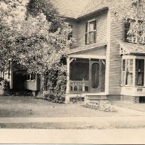
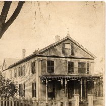
Barlow house at 17 Pease Avenue
Black and white picture postcard of house located at 17 Pease Avenue. At the time the photo was taken house was owned by the Barlow's. Taken looking northwest.
Record Type: Photo
-
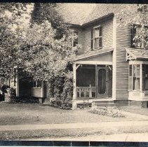
Barlow house at 17 Pease Avenue
Black and white picture postcard of house located at 17 Pease Avenue. At the time the photo was taken house was owned by the Barlow's. Taken looking northwest.
Record Type: Photo
-
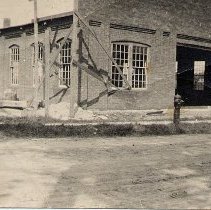
Brick Garage Building at 6 State Street
Brick Garage Building at 6 State Street that appears could still be under construction. On the April 1918 Sanborn Map it is identified as a Garage with the capacity of 15 cars.
Record Type: Photo
-
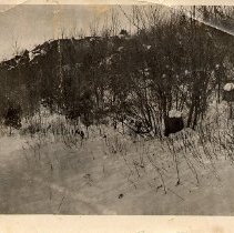
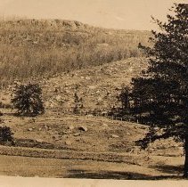
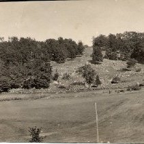
Cat Rock
Black and white photograph of Cat Rock which is behind and east of Pease Avenue.
Record Type: Photo
-
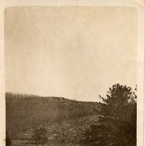
Cat Rock
Black and white photograph of Cat Rock taken from behind Pease Avenue looking east.
Record Type: Photo
-
Cat Rock
Black and white picture postcard of Cat Rock which is located east of Pease Avenue.
Record Type: Photo
-
Cat Rock
Black and white photograph of Cat Rock which is behind and east of Pease Avenue.
Record Type: Photo
-
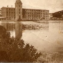
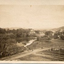
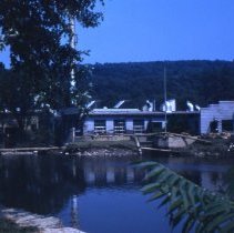
Cushman Mill
Black and white photograph of Cushman Mill looking northeast across pond.
Record Type: Photo
-
Edward Cushman house on 106 Main Street
Black and white photograph of Edward Cushman house on 106 Main Street.. Photo taken looking east.
Record Type: Photo
-
Factory Boarding House for Ricketts & Shaw
Black and white picture postcard looking northwest at Factory Boarding House for Ricketts & Shaw Woolen Mills on what is now Bliss Street.
Record Type: Photo
-
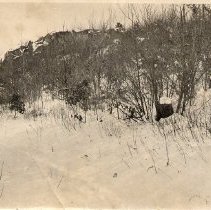
Field behind Orrin McCray's house Cushman Street
Black and white photograph of the field behind Orrin McCray's house at 40 Cushman Street. Taken looking east.
Record Type: Photo
-
Flood of 1955 damage - 08/19/1955
Color slide showing the destruction from the Flood of 1955 on Oak Street at the intersection of Bliss Street looking west.
Record Type: Photo
-
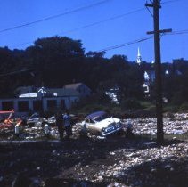
Flood of 1955 damage - 08/19/1955
Color slide showing the destruction from the Flood of 1955 on Main Street Route 32 at the intersection of Oak Street.
Record Type: Photo

-
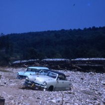
Flood of 1955 damage - 08/19/1955
Color slide showing the destruction from the Flood of 1955 by C. F. Church Company on Palmer Road.
Record Type: Photo
-
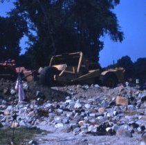
Flood of 1955 damage at C. F. Church Company parking lot - 08/19/1955
Color slide showing the destruction from the Flood of 1955 at C. F. Church Company Parking Lot looking northeast.
Record Type: Photo
-
Flood of 1955 damage near the Soldiers' Monument - 08/19/1955
Color slide showing the destruction from the Flood of 1955 and the start of the clean-up at the Soldiers' Monument.
Record Type: Photo
-
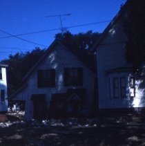
Flood of 1955 damage on Hampden Avenue - 08/19/1955
Color slide showing destruction from the Flood of 1955 on Hampden Avenue.
Record Type: Photo
-
Flood of 1955 damage on State Street - 08/19/1955
Color slide showing the destruction done by the Flood of 1955 to State Street looking north.
Record Type: Photo
-
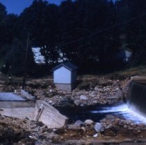
Flood of 1955 damage to Conant Dam Bridge - 08/19/1955
Color slide showing the destruction from the Flood of 1955 at Conant Dam Bridge.
Record Type: Photo
-
Flood of 1955 damage to Ely Road - 08/19/1955
Color slide showing the destruction from the Flood of 1955 on Ely Road.
Record Type: Photo